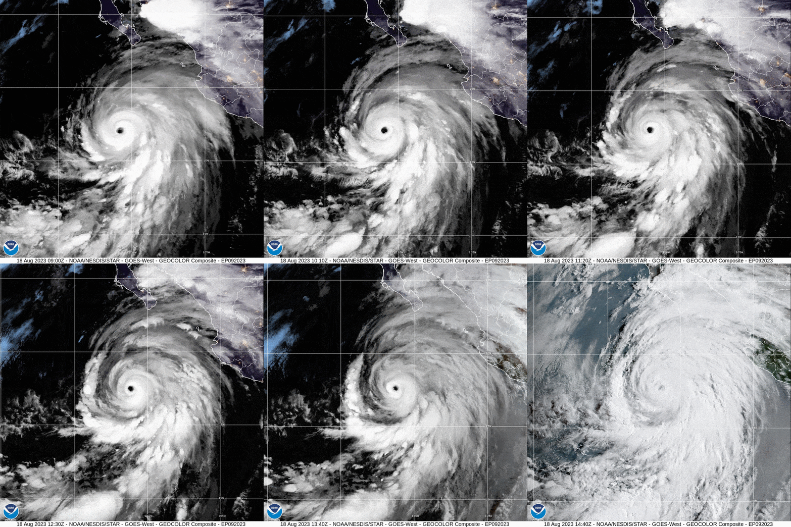
Southern California hasn’t seen a direct hit from a tropical storm since 1939, when an unnamed tempest made landfall at Long Beach on September 25 and caused dozens of deaths. Now the state could see another tropical storm make landfall as Hurricane Hilary barrels toward Baja California and the U.S. Southwest. The National Hurricane Center (NHC) has issued the first ever Tropical Storm Watch for the West Coast.
Regardless of where Hilary hits, a vast area of southern California, southern Nevada and western Arizona are expected to experience heavy rains that pose a major risk for flash flooding. More than a year’s worth of rain could drop on some areas in just a couple of days.
Hilary formed off the western coast of Mexico in the eastern Pacific Ocean on Wednesday. Between Thursday and Friday the storm rapidly intensified from a Category 2 hurricane to powerful Category 4, fueled by ample warm ocean waters that fed into Hilary’s convection and a lack of the crisscrossing winds that can hamper a storm. Hilary is expected to weaken as it approaches land because it will be moving over colder waters.
Meteorologists currently forecast that the storm will make landfall in Baja California as a hurricane. Very small deviations in its track could see it skirt the coast of Mexico and instead hit California, however. By that point in the latter scenario, Hilary might weaken to a tropical storm—or possibly a post-tropical storm, a type that is fueled by different atmospheric processes but that can still pack just as much of a punch. “Regardless of whether it’s a tropical storm or an extratropical system, the impacts are still going to be the same,” says Samantha Connolly, a meteorologist at the National Weather Service’s office in San Diego.
Although those impacts include strong winds, the biggest danger will come from torrential rains. The amount of rain could total three to six inches over a wide area between Saturday and Monday, with some places seeing as much as 10 inches. That much precipitation would pose a threat of flash floods anywhere but particularly in the dry soils of the desert. “It’s not going to be absorbed very well,” Connolly says.
The possibility that torrents of water will run down mountain slopes, engorge waterways, and flood streets and communities, means residents should pay attention to their local weather sources and alerts. And people should avoid flood-prone areas. “Rainfall flooding is responsible for most of the fatalities from tropical storms and hurricanes in the United States,” said NHC’s director Michael Brennan during a live streamed briefing on Friday morning.
And because Hilary is a large storm, those rains will start falling well before its center makes landfall, Brennan said.
Southern California and the broader Southwest are typically impacted by the remnants of tropical systems from the eastern Pacific, Connolly says. Just last year the remnants of Hurricane Kay caused heavy rains, with resulting flooding and mudflows, in California. But this will be a particularly strong event, Connolly adds.
California rarely sees direct hits from tropical cyclones (the broad term for tropical storms and hurricanes) because prevailing atmospheric currents send any storms that form in the subtropics to the west and northwest. In the case of the eastern Pacific Ocean, this atmospheric setup takes them away from the continental U.S. The relatively cold waters off the West Coast also typically cause any storms that do head toward land to weaken before they can make landfall. A hurricane struck San Diego, Calif., in October 1858, however, and caused considerable damage.
In the case of Hilary, a strong area of high pressure stuck over the central part of the U.S.—which will usher in a heat wave in those areas—and a low-pressure area to the west of California are forcing Hilary more northward, said Daniel Swain, a climate scientist at the University of California, Los Angeles, and the National Center for Atmospheric Research, during one of his regular “virtual climate and weather office hours,” hosted on YouTube. If you have a strong storm moving quickly along such a path, it may not fall apart as soon as it normally would, setting up the rare possibility of a tropical cyclone hitting the state, he added.
When an El Niño is in place, as it is now, the climate pattern can ramp up hurricane activity in the eastern Pacific because it shifts atmospheric circulation patterns in ways that reduce the crosscutting winds that can hamper storm formation and strengthening over the area. (El Niño typically has the opposite effect in the Atlantic Ocean, where it usually increases these winds, tamping down hurricane activity. But this year exceptionally warm ocean waters are expected to override that influence, with NHC forecasting above-average hurricane activity there.)
Considerable research has focused on the potential effects of climate change on tropical cyclones. Broadly speaking, there is evidence that overall storm numbers could decrease while storm intensity might increase, with a higher proportion of hurricanes in the stronger categories. There is also evidence that rainfall associated with tropical cyclones will increase with warming.
As to whether tropical systems may affect California more frequently in a warmer future, in his YouTube talk, Swain said that although this hasn’t been formally studied to his knowledge, such a scenario is possible. “It’s been rare historically, and it will probably still be pretty rare in the future but maybe somewhat less so,” he said. That is because of warming oceans. “There’s no way that southern California waters are going to warm high enough to support the development of tropical cyclones, but the water off the coast of Baja California will possibly warm enough to be less effective at killing them off if they do form and have this northward trajectory,” he added. “So events like this might become a bit more common.”


